Your guide to navigating Plano, Texas! If you’re a resident looking to explore different transportation methods or a visitor planning your trip around the city, Plano offers various options to suit your travel needs. This thriving Dallas suburb combines charm with convenience, providing multiple ways to get around—from efficient public transit to driver-friendly roads and extensive biking trails. Let’s look at the various transportation options that make Plano accessible and easy to navigate for everyone.
Public Transit in Plano: Overview of DART services
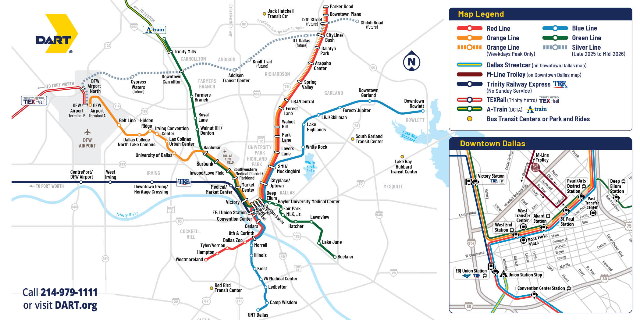
- Explore DART services with this handy map of Plano’s public transit routes. Source: visitplano.com
Plano residents and visitors benefit from Dallas Area Rapid Transit (DART), which provides public transportation throughout the city and connects to the greater Dallas-Fort Worth area. DART’s light rail system features three key stations in Plano—Parker Road, Downtown Plano, and CityLine/Bush—making it easy to travel within the city or venture into downtown Dallas. The rail service runs frequently throughout the day, offering an efficient alternative to driving, especially during peak traffic hours. Additionally, DART operates an extensive bus network with routes covering most major areas of Plano, ensuring accessibility to shopping centers, business districts, and residential neighborhoods.
For areas not directly served by fixed-route buses, DART offers GoLink, an on-demand shuttle service that can be booked through the user-friendly GoPass app or by phone. This service provides flexible transportation within designated zones, ideal for first-mile/last-mile connections. Looking ahead, Plano commuters can anticipate the upcoming Silver Line Regional Rail, scheduled to open between late 2025 and early 2026. This new service will feature two stations in Plano and will offer a direct connection to DFW Airport, significantly improving regional mobility options. For trip planning assistance and the latest service updates, travelers can visit DART.org or contact DART Customer Service at 214-979-1111.
- Navigate Plano’s road networks with ease – tips for a smooth driving experience. Source: visitplano.com
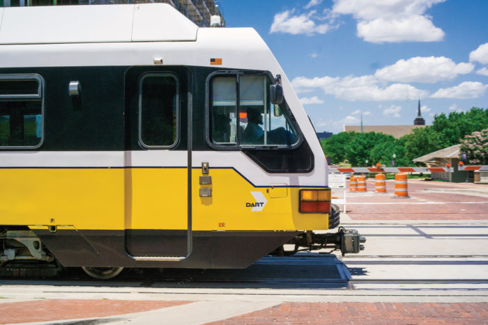
Driving in Plano: Information about road networks
Plano’s well-maintained road network makes driving a popular and convenient option for residents and visitors alike. The city is strategically positioned with easy access to major highways, including US-75 (Central Expressway) running north-south through Plano, the Dallas North Tollway on the western edge, and President George Bush Turnpike along the southern border. These major roads provide quick connections to neighboring communities and downtown Dallas, which is approximately 20 miles south. Within the city, Plano’s grid-like street layout makes navigation straightforward, with major east-west corridors like Parker Road, Park Boulevard, and Legacy Drive intersecting with north-south routes such as Preston Road, Coit Road, and Independence Parkway.
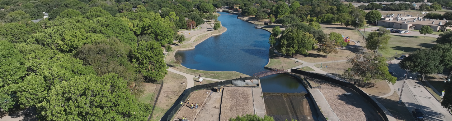
- Discover Plano’s extensive biking and walking trails for a scenic commute. Source: plano.gov
Travelers should note that while Plano generally experiences less congestion than downtown Dallas, rush hour traffic (roughly 7-9 AM and 4-7 PM on weekdays) can be heavy, particularly near highway interchanges and around major employment centers like Legacy Business Park. For those utilizing the region’s toll roads, the North Texas Tollway Authority (NTTA) offers the convenient Zip-Pass system. This temporary tolling solution is ideal for visitors driving rental vehicles or borrowed cars, with accounts starting at just $5 per day (minimum $20 balance). Unlike rental car companies’ often costly toll options, unused Zip-Pass balances are refunded, making it an economical choice for short-term visitors. To set up a Zip-Pass account, simply call NTTA Customer Service and provide your vehicle and payment information.
Biking and Walking in Plano: Details about the city’s extensive trail system
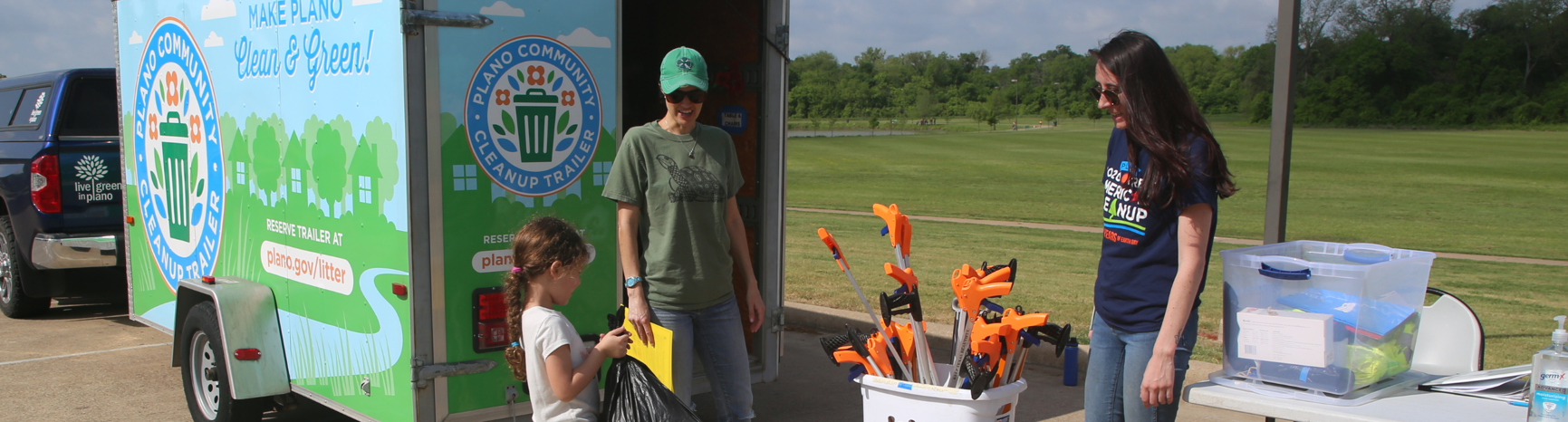
- Join the Try Parking It program and explore carpooling options in Plano. Source: plano.gov
Plano has established itself as a remarkably bike-friendly city, boasting an impressive network that includes over 150 miles of on-street bicycle routes complemented by nearly 100 miles of shared-use paths. This extensive system makes cycling a viable option for both recreational and daily transportation needs. The on-street bike network features clearly marked neighborhood routes and a dedicated cycle track, while the shared-use paths—varying between 8 and 12 feet wide—connect throughout Plano’s park system. Popular routes include the scenic Chisholm Trail, Bluebonnet Trail, and Preston Ridge Trail, each offering unique views of the city’s landscape. For those new to Plano’s cycling infrastructure, free bike maps are readily available at city recreation centers and libraries, and an interactive Bike & Pedestrian Mobility Map can be accessed online.
Safety remains a priority throughout Plano’s trail system, evidenced by the implementation of the Emergency Trail Marker System, which helps users accurately report their location in case assistance is needed. The city has also installed hybrid beacon lights at key road crossings like Alma Road to enhance pedestrian and cyclist safety. For walkers, Plano maintains an impressive 1,700+ miles of sidewalks that connect neighborhoods, business districts, and recreational areas. The Parks and Recreation Department continues to expand these networks, focusing on creating connections that serve cyclists and pedestrians of all ages and abilities. Whether you’re commuting to work, running errands, or simply enjoying leisure time, Plano’s extensive walking and biking infrastructure offers a sustainable and healthy alternative to driving.
Alternative Transportation Options: Carpooling and Ride-sharing
Beyond public transit, driving, and biking, Plano residents and visitors have access to several innovative alternative transportation solutions. The Try Parking It program stands out as a regional initiative designed to reduce traffic congestion and improve air quality. This ride-matching service connects commuters for carpooling and vanpooling opportunities throughout North Central Texas. Participants can also find transit companions and biking or walking buddies through the platform. What makes this program particularly attractive is its reward system—active users earn points that can be redeemed for various prizes. The more consistently you participate in alternative transportation methods, the more rewards you can accumulate, creating both environmental and personal incentives for sustainable commuting.
For those who need more flexibility than fixed-route services provide, Plano is well-served by ride-sharing platforms, taxi services, and shuttle options. Major ride-sharing companies operate throughout the city, offering on-demand transportation with just a few taps on your smartphone. Visitors staying at local hotels can often access shuttle services to nearby attractions, shopping centers, and business districts. For special occasions or group travel, several companies offer limousine and charter bus services in the Plano area. These alternative transportation options enhance mobility throughout the city, particularly for visitors unfamiliar with the local transit system or those without access to personal vehicles. Whether you’re exploring Plano’s shopping destinations, dining scenes, or cultural attractions, these flexible transportation alternatives ensure that getting around remains convenient and stress-free.